Navigation on Neverland: I Have Eight GPS Receivers. Guess What They Have in Common.
We'll have more GPS receivers aboard than we know what to do with. Here's why I'm still learning to navigate by the stars.

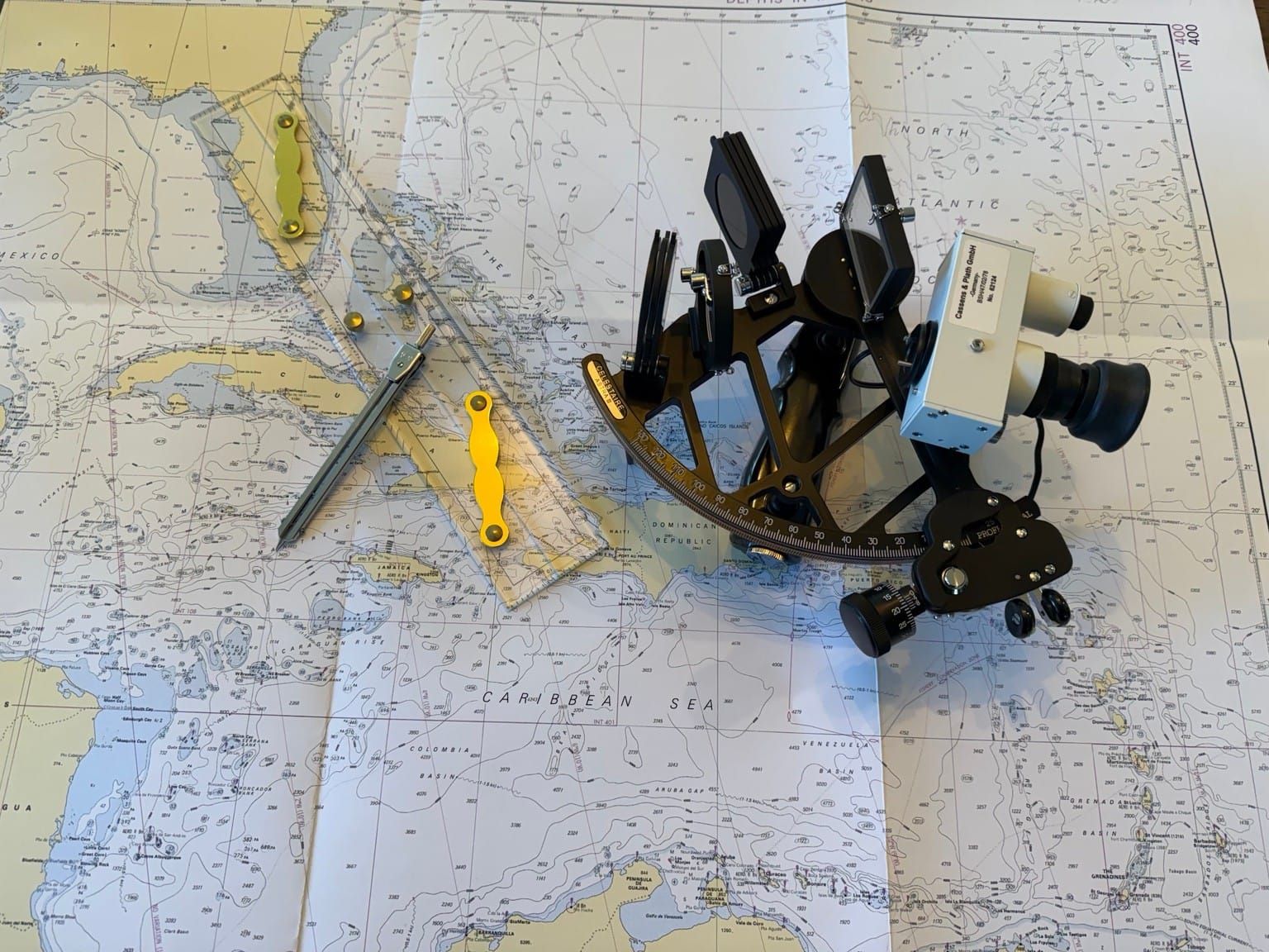
As we put together the navigation setup for Neverland, we’re planning for backups upon backups.
Our primary system will be a B&G Zeus SR chartplotter at the helm, with a second B&G chartplotter at the nav station. That gives us access to our charts and navigation information both where we’re sailing the boat and where we’re planning the passage.
But the chartplotters are just the beginning. We’ll also have:
- A PredictWind DataHub with a GPS antenna, connected to the boat’s NMEA 2000 network
- A USB-C GPS puck for my laptop loaded with OpenCPN and predictwind
- Starlink’s GPS
- The GPS in my phone with navionics and predict wind
- The GPS in my watch
- A Garmin inReach Messenger with GPS
These devices don’t all serve the same purpose, and having a GPS receiver inside something doesn’t necessarily make it a convenient navigation system. Still, the number of devices we’ll have that can determine or use our position is borderline ridiculous.
 Yo dog, I heard you like GPS,so I gave your GPS some GPS
That redundancy should be reassuring. For most ordinary equipment failures, it is. If the helm chartplotter stops working, we have another display at the nav station. If we have a problem with the boat’s network or power, a laptop, phone, or handheld device with its own battery and GPS receiver gives us another option, assuming it has the charts and software we need.
But looking at that list raises another question: how independent are those backups?
A lot of devices, one shared dependency
For the last thirty years, we’ve become accustomed to having position, navigation, and timing available through GPS. PNT, if you want another acronym to remember. Turn something on, give it a moment, and it tells you where you are. It’s easy to start treating that information as something that will always be there.
Recent global events have made me reassess that assumption. What happens if satellite navigation is disrupted where we’re sailing?
A failed chart plotter and an unreliable satellite signal are different problems. Another receiver may solve the first one. It may not solve the second. If the signals those receivers rely on are being interfered with, switching from the chart plotter to my phone doesn’t necessarily solve the problem.
And losing the position display altogether isn’t the only possibility. A position that looks convincing but is wrong could be harder to recognize than a screen that simply stops working. Recently, Britain's Marine and Coastguard Agency highlighted this risk for mariners as GPS jamming and spoofing have become more prevalent.

That doesn’t mean every device will fail in every disruption. Some receivers can also use satellite systems other than GPS. But counting devices isn’t quite the same as counting independent ways to navigate. If all our options depend on receiving satellite navigation signals, they share a vulnerability.
Then there are problems aboard the boat itself. A lightning strike, for example, could damage electronics without anything being wrong with the satellites. That’s a different problem from signal interference, but it could leave us asking the same practical question: what do we do if we can’t rely on the electronic position in front of us?
Going back before GPS
We go back to some of the methods sailors used before GPS.
That doesn’t mean throwing away the chart plotters. It means having other ways to keep track of where we are and, when possible, check that position.

We can start practicing our dead reckoning. Beginning with our last known position, we can plot the course we’ve steered, our speed through the water, and the time we’ve been traveling. We can also account for what we know about current and leeway to improve that estimate. Every morning of my ASA 104 course, we looked up the current and tide data and used it to inform our passage planning. Since then, I have gotten out of that habit. Maybe it’s time to brush off a few more references and almanacs. It won’t give us a perfect position down to the nanometer, and the uncertainty grows the farther we travel without a new fix, but it gives us somewhere to start.
Closer to land, we have more options. We can take compass bearings to recognizable features and plot them on a chart. If the electronics are working, radar can provide ranges or bearings to charted features, and the depth sounder can help us compare what’s under the boat with what’s on the chart. Each method has its limitations, but together they give us ways to check the picture we’re building.
Offshore, without land in sight, we have another option: celestial navigation.
 We don’t know who struck first, us or themBut we do know it was us that scorched the sky.
Celestial navigation works. The stars aren’t going anywhere, regardless of what Morpheus said.
Of course, we still need to see them, or the Sun, and know what to do with the observation. A sextant sitting in a locker isn’t much of a backup if I’ve never learned to use it. We also need accurate time, an almanac, and a way to turn what we measure into a line of position. And celestial navigation isn’t a replacement for all the information on a chart plotter. But it gives us a way to check our position that doesn’t depend on receiving a satellite-navigation signal.
In addition to using an actual sextant, there’s another option I’m experimenting with. At the Annapolis boat show, I came across EZ Sextant, an app that uses your phone’s camera for celestial navigation. You photograph a celestial body and the horizon, and the app works out lines of position and a running fix without needing an ongoing GPS fix or an internet connection. It needs calibration at a known position, accurate time and a clear horizon, and it still depends on a working, charged phone. I can’t say how well it works in practice, but I’m looking forward to testing it as another way to navigate without relying on satellite signals.
A practical reason for a romantic idea

I’ve always been interested in how sailors navigated before all this technology was available. There’s something appealing about being able to look at the sky and work out where you are.
The less I rely on technology as a mediator between me and the sea, the more connected I feel to it. That has always been a somewhat romantic reason to learn celestial navigation. Now I have a practical reason as well.
Towards that end, I put together a series covering the basics, both as a way for me to check my own understanding of the concepts and as an introduction for others.
- Part 1: The math that makes the world go round
- Part 2: Turning sunshine into math (working a Sun sight)
- Part 3: Connecting the dots (plotting a running fix)
- Part 4: High noon, low math (latitude by noon sight)
- Part 5: Finding the second star on the right (identifying stars and planets)
- Part 6: The Sun clocked out, but the math didn’t (working star and planet sights)
- Part 7: Three lines walk into a bar (plotting a three-body fix)
The electronics will still do most of the navigation work aboard Neverland. I just want to understand how to find our way when another GPS receiver isn’t the answer.